Elm Lane, Redland, Bristol
Introduction
The photograph on this page of Elm Lane, Redland, Bristol by Ken Ripper as part of the Geograph project.
The Geograph project started in 2005 with the aim of publishing, organising and preserving representative images for every square kilometre of Great Britain, Ireland and the Isle of Man.

There are currently over 7.5m images from over 14,400 individuals and you can help contribute to the project by visiting https://www.geograph.org.uk
Elm Lane, Redland, Bristol
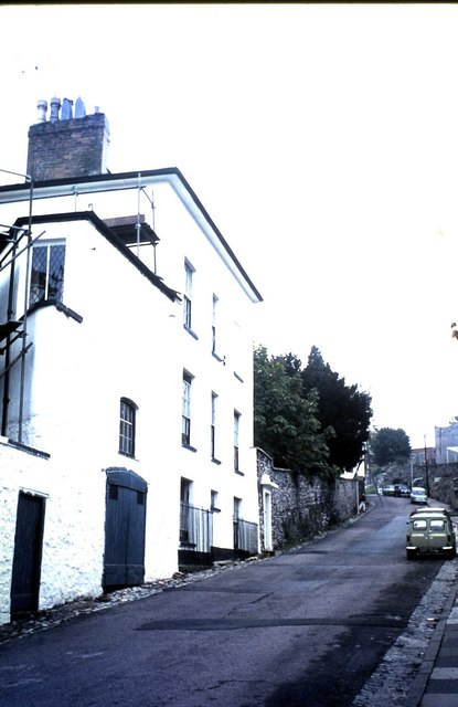
Image: © Ken Ripper Taken: Unknown
The white building on the left is Elm House which was a student hostel in 1969 when this image was taken. The students were at Redland Teacher Training College in Bristol.
Images are licensed for reuse under creativecommons.org/licenses/by-sa/2.0
Image Location
Latitude
51.470933
Longitude
-2.610675