View from Dorket Head trig point
Introduction
The photograph on this page of View from Dorket Head trig point by Alan Murray-Rust as part of the Geograph project.
The Geograph project started in 2005 with the aim of publishing, organising and preserving representative images for every square kilometre of Great Britain, Ireland and the Isle of Man.

There are currently over 7.5m images from over 14,400 individuals and you can help contribute to the project by visiting https://www.geograph.org.uk
View from Dorket Head trig point
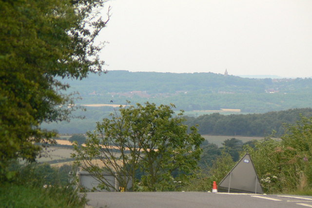
Image: © Alan Murray-Rust Taken: 20 Jul 2010
The choice of this location as a trig point is obvious. Despite the relatively low height (around 145 metres) the views between west through south to north east were exceptional, although the growth of screens of trees to the adjacent brickworks have obliterated much of the view. This is the view to the north west, which still provides views across to the peak district on days less hazy than this. The spire is that of Annesley Church, some 10km distant.
Images are licensed for reuse under creativecommons.org/licenses/by-sa/2.0
Image Location
Latitude
53.021415
Longitude
-1.115472