Benburb Street, Belfast (1)
Introduction
The photograph on this page of Benburb Street, Belfast (1) by Albert Bridge as part of the Geograph project.
The Geograph project started in 2005 with the aim of publishing, organising and preserving representative images for every square kilometre of Great Britain, Ireland and the Isle of Man.

There are currently over 7.5m images from over 14,400 individuals and you can help contribute to the project by visiting https://www.geograph.org.uk
Benburb Street, Belfast (1)
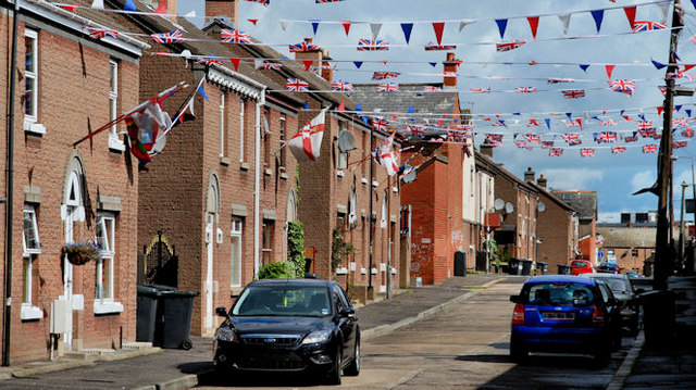
Image: © Albert Bridge Taken: 10 Aug 2010
Benburb Street runs from Tate’s Avenue to the Donegall Road. The street was built towards the end of the 19th century but has since been partly redeveloped. Ruby Murray’s former home (odds side – left) no longer exists. Image shows the Donegall Road end of the street in April 2012.
Images are licensed for reuse under creativecommons.org/licenses/by-sa/2.0
Image Location
Latitude
54.586187
Longitude
-5.956937