Marlow Bottom Methodist Church
Introduction
The photograph on this page of Marlow Bottom Methodist Church by David Hillas as part of the Geograph project.
The Geograph project started in 2005 with the aim of publishing, organising and preserving representative images for every square kilometre of Great Britain, Ireland and the Isle of Man.

There are currently over 7.5m images from over 14,400 individuals and you can help contribute to the project by visiting https://www.geograph.org.uk
Marlow Bottom Methodist Church
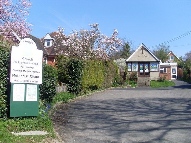
Image: © David Hillas Taken: 13 Apr 2010
Located at 148 Marlow Bottom Road, SL7 3PP, this Church is one of twelve in the High Wycombe Methodist Circuit. The notice on the left says that it is in an Anglican/Methodist Partnership serving Marlow Bottom.
Images are licensed for reuse under creativecommons.org/licenses/by-sa/2.0
Image Location
Latitude
51.590742
Longitude
-0.782353