Wish Tower
Introduction
The photograph on this page of Wish Tower by Paul Gillett as part of the Geograph project.
The Geograph project started in 2005 with the aim of publishing, organising and preserving representative images for every square kilometre of Great Britain, Ireland and the Isle of Man.

There are currently over 7.5m images from over 14,400 individuals and you can help contribute to the project by visiting https://www.geograph.org.uk
Wish Tower
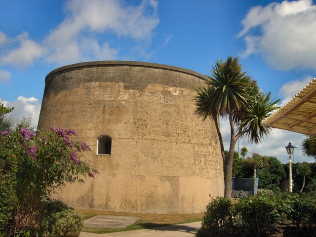
Image: © Paul Gillett Taken: 7 Aug 2010
The name of the tower comes from the 'wish', 'wash' or marshland nearby, fed by a stream known as Shomer Dyke. Twiss himself first referred to it as the "Whish Tower" or "Wish Tower" in some of his early progress reports http://www.martello-towers.co.uk/south-coast/towers/73.htm
Images are licensed for reuse under creativecommons.org/licenses/by-sa/2.0
Image Location
Latitude
50.760869
Longitude
0.28625