Central reservation gap near Banbridge (3)
Introduction
The photograph on this page of Central reservation gap near Banbridge (3) by Albert Bridge as part of the Geograph project.
The Geograph project started in 2005 with the aim of publishing, organising and preserving representative images for every square kilometre of Great Britain, Ireland and the Isle of Man.

There are currently over 7.5m images from over 14,400 individuals and you can help contribute to the project by visiting https://www.geograph.org.uk
Central reservation gap near Banbridge (3)
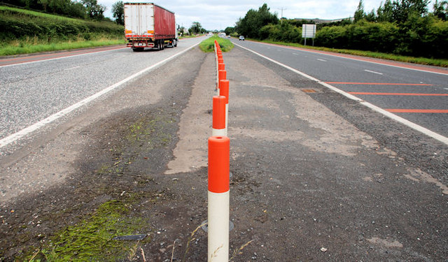
Image: © Albert Bridge Taken: 7 Aug 2010
Gap, on the Banbridge side of the Graceystown Road, at Tullyraine. Now closed using plastic bollards. There is a field entrance nearby but I cannot remember any other entrances here. The red lines (right) precede the 60mph zone for the Banbridge bypass.
Images are licensed for reuse under creativecommons.org/licenses/by-sa/2.0
Image Location
Latitude
54.362923
Longitude
-6.224829