The river confluence at Lynmouth
Introduction
The photograph on this page of The river confluence at Lynmouth by Graham Horn as part of the Geograph project.
The Geograph project started in 2005 with the aim of publishing, organising and preserving representative images for every square kilometre of Great Britain, Ireland and the Isle of Man.

There are currently over 7.5m images from over 14,400 individuals and you can help contribute to the project by visiting https://www.geograph.org.uk
The river confluence at Lynmouth
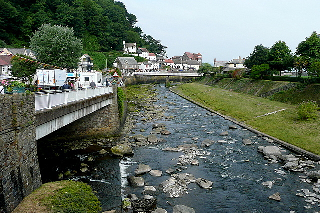
Image: © Graham Horn Taken: 23 Jul 2010
Looking from the A39 road bridge, under which flows the East Lyn River. The West Lyn River joins from the left and together they flow to the sea a few hundred metres ahead. This is a new channel for the rivers, built after the August 1952 floods, and is three times as wide and deep as the original course, which was slightly further to the left nearer the town. Although calm today, there can still be a significant amount of water coming through this area after rain on the moors.
Images are licensed for reuse under creativecommons.org/licenses/by-sa/2.0
Image Location
Latitude
51.230358
Longitude
-3.830343