Christchurch, The Fairmile
Introduction
The photograph on this page of Christchurch, The Fairmile by Mike Faherty as part of the Geograph project.
The Geograph project started in 2005 with the aim of publishing, organising and preserving representative images for every square kilometre of Great Britain, Ireland and the Isle of Man.

There are currently over 7.5m images from over 14,400 individuals and you can help contribute to the project by visiting https://www.geograph.org.uk
Christchurch, The Fairmile
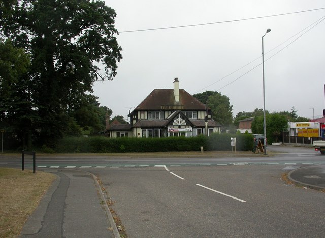
Image: © Mike Faherty Taken: 6 Aug 2010
Brewers' Tudor pub on Fairmile Road. Internally, curving central bar, with eating and drinking areas to left and right, pool at back. Cask ale on offer at my visit: Ringwood Best. For some customer comments, see http://www.beerintheevening.com/pubs/comments.shtml/2569/ . Sadly, from a thirsty local resident's point-of-view, the pub has closed (2015), despite local objections http://www.theargus.co.uk/news/10899274.Traders_fight_application_to_convert_derelict_Fairmile_pub_into_Co_op_store/ , and has been "revamped" into a Co-op local (see Image).
Images are licensed for reuse under creativecommons.org/licenses/by-sa/2.0
Image Location
Latitude
50.74803
Longitude
-1.793005