Hill farms in Cwm Brefi, Ceredigion
Introduction
The photograph on this page of Hill farms in Cwm Brefi, Ceredigion by Roger D Kidd as part of the Geograph project.
The Geograph project started in 2005 with the aim of publishing, organising and preserving representative images for every square kilometre of Great Britain, Ireland and the Isle of Man.

There are currently over 7.5m images from over 14,400 individuals and you can help contribute to the project by visiting https://www.geograph.org.uk
Hill farms in Cwm Brefi, Ceredigion
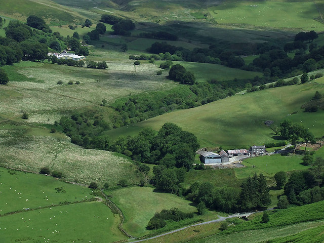
Image: © Roger D Kidd Taken: 11 Jul 2010
Seen with a telephoto lens from the Bancau Duon hillside are the farms at Aberdauddwr (on the right), about a thousand yards/metres away, and Carnau (about 1400 metres/three quarters of a mile away). The Afon Brefi descends among the trees across the centre of the image. The river meets the Afon Dulas, coming in from the right, this side of the bridge, bottom right. Image
Images are licensed for reuse under creativecommons.org/licenses/by-sa/2.0
Image Location
Latitude
52.17299
Longitude
-3.911061