Victoria Road, Woolston
Introduction
The photograph on this page of Victoria Road, Woolston by Rob Candlish as part of the Geograph project.
The Geograph project started in 2005 with the aim of publishing, organising and preserving representative images for every square kilometre of Great Britain, Ireland and the Isle of Man.

There are currently over 7.5m images from over 14,400 individuals and you can help contribute to the project by visiting https://www.geograph.org.uk
Victoria Road, Woolston
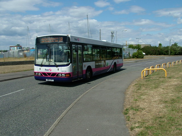
Image: © Rob Candlish Taken: 5 Aug 2010
First Group 66128(S118JTP), a Wrights bodied Volvo B10BLE, approaching the sharp left hand bend in Victoria Road, Woolston outside Southampton Sailing Club on route 1A to Weston. In the background is the mobile telephone mast inside Woolston sewage works. Behind the yellow railings to the right is a public car park.
Images are licensed for reuse under creativecommons.org/licenses/by-sa/2.0
Image Location
Latitude
50.889654
Longitude
-1.382925