Elenydd hillside with farm, east of Llanddewi-Brefi, Ceredigion
Introduction
The photograph on this page of Elenydd hillside with farm, east of Llanddewi-Brefi, Ceredigion by Roger D Kidd as part of the Geograph project.
The Geograph project started in 2005 with the aim of publishing, organising and preserving representative images for every square kilometre of Great Britain, Ireland and the Isle of Man.

There are currently over 7.5m images from over 14,400 individuals and you can help contribute to the project by visiting https://www.geograph.org.uk
Elenydd hillside with farm, east of Llanddewi-Brefi, Ceredigion
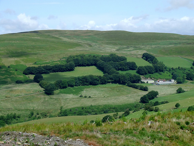
Image: © Roger D Kidd Taken: 11 Jul 2010
The farm has been photographed with telephoto assistance, and is about three quarters of a mile (1.3 km) distant, in upper Cwm Brefi. The cairn on Brynn Rhudd (480m metres, 1575 feet) shows as a pimple on the skyline.
Images are licensed for reuse under creativecommons.org/licenses/by-sa/2.0
Image Location
Latitude
52.177657
Longitude
-3.909359