Rhine near Great Leaze Farm
Introduction
The photograph on this page of Rhine near Great Leaze Farm by Robin Stott as part of the Geograph project.
The Geograph project started in 2005 with the aim of publishing, organising and preserving representative images for every square kilometre of Great Britain, Ireland and the Isle of Man.

There are currently over 7.5m images from over 14,400 individuals and you can help contribute to the project by visiting https://www.geograph.org.uk
Rhine near Great Leaze Farm
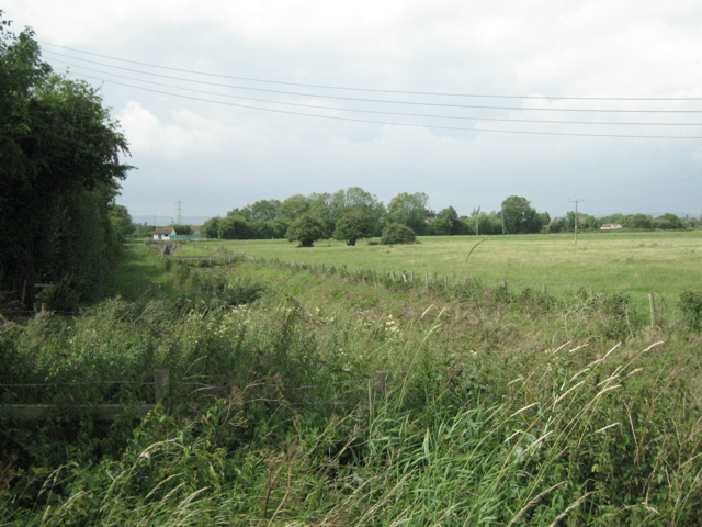
Image: © Robin Stott Taken: 27 Jul 2010
The small building on the left is the Oldbury Naite pumping station of the Lower Severn Internal Drainage Board. The rhine (pronounced 'reen') beside it is seen in Image Two characteristic plants of this habitat stand out. White blobs below centre are flowerheads of meadowsweet (Filipendula ulmaria). The elegant grass, right foreground, is Reed Canary-grass (Phalaris arundinacea). Arundinacea means reed-like.
Images are licensed for reuse under creativecommons.org/licenses/by-sa/2.0
Image Location
Latitude
51.635435
Longitude
-2.546127