Former Sunday School, Langthwaite
Introduction
The photograph on this page of Former Sunday School, Langthwaite by Gordon Hatton as part of the Geograph project.
The Geograph project started in 2005 with the aim of publishing, organising and preserving representative images for every square kilometre of Great Britain, Ireland and the Isle of Man.

There are currently over 7.5m images from over 14,400 individuals and you can help contribute to the project by visiting https://www.geograph.org.uk
Former Sunday School, Langthwaite
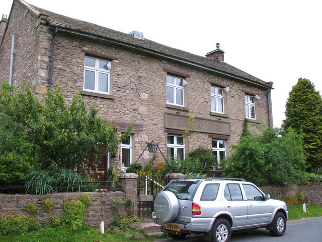
Image: © Gordon Hatton Taken: 28 Jul 2010
The inscription on the front of the building reads 'Wesleyan Sunday School and Institute 1923'. The building is a few metres along the road from the Wesleyan Chapel, but one wonders why such a large building was erected in 1923, long after the demise of the local lead mining industry and when the Arkengarthdale population was already in decline. Now in use as a private residence.
Images are licensed for reuse under creativecommons.org/licenses/by-sa/2.0
Image Location
Latitude
54.417943
Longitude
-1.995498