St Matthews Church, West Wimbledon
Introduction
The photograph on this page of St Matthews Church, West Wimbledon by Richard Rogerson as part of the Geograph project.
The Geograph project started in 2005 with the aim of publishing, organising and preserving representative images for every square kilometre of Great Britain, Ireland and the Isle of Man.

There are currently over 7.5m images from over 14,400 individuals and you can help contribute to the project by visiting https://www.geograph.org.uk
St Matthews Church, West Wimbledon
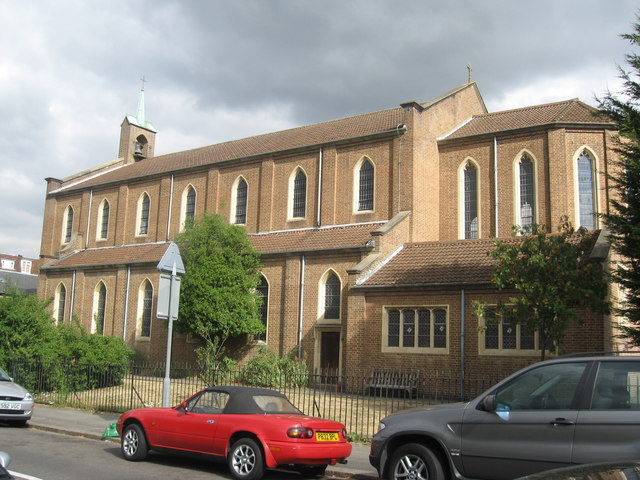
Image: © Richard Rogerson Taken: 30 Jul 2010
St Matthew’s Church was built after the Second World War to replace the earlier church destroyed in World War Two. At 8.30pm on 29 June 1944 the church was totally destroyed by a flying bomb. It was designed by Sebastian Comper. The foundation stone was laid in 1957 and on 6 December 1958 the new church was dedicated http://www.stmatthews.ww.btinternet.co.uk/ch_history.html
Images are licensed for reuse under creativecommons.org/licenses/by-sa/2.0
Image Location
Latitude
51.412012
Longitude
-0.233636