St Mary's, Potton
Introduction
The photograph on this page of St Mary's, Potton by Mike Snoswell as part of the Geograph project.
The Geograph project started in 2005 with the aim of publishing, organising and preserving representative images for every square kilometre of Great Britain, Ireland and the Isle of Man.

There are currently over 7.5m images from over 14,400 individuals and you can help contribute to the project by visiting https://www.geograph.org.uk
St Mary's, Potton
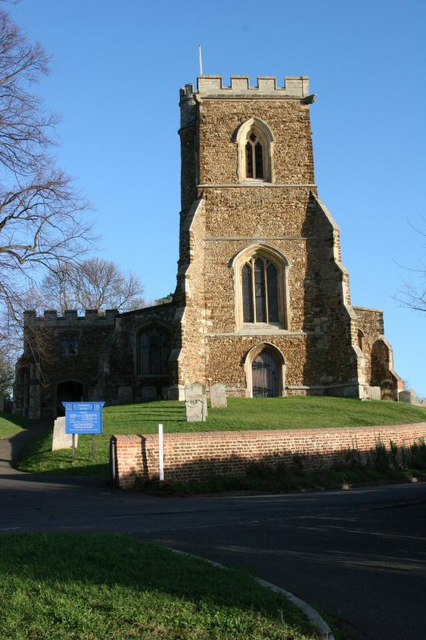
Image: © Mike Snoswell Taken: 9 Jan 2005
St Mary's is situated on a small hill on the edge of Potton. An ancient right of way (locally called the Church Causeway) leads from opposite the Church to the centre of Potton. The Church recently celebrated its 900th anniversary although the present building mostly originates from the 13th Century.
Images are licensed for reuse under creativecommons.org/licenses/by-sa/2.0
Image Location
Latitude
52.128373
Longitude
-0.207491