Disused road bridge over Nant Pibwr
Introduction
The photograph on this page of Disused road bridge over Nant Pibwr by Nigel Davies as part of the Geograph project.
The Geograph project started in 2005 with the aim of publishing, organising and preserving representative images for every square kilometre of Great Britain, Ireland and the Isle of Man.

There are currently over 7.5m images from over 14,400 individuals and you can help contribute to the project by visiting https://www.geograph.org.uk
Disused road bridge over Nant Pibwr
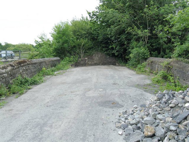
Image: © Nigel Davies Taken: 11 Jul 2010
The A484 has been rebuilt here. Few traces of the original road remain but a short section containing the old bridge forms a lay-by, field access and a dump site for road materials. The new bridge is immediately adjacent - upstream. A car can be seen crossing it at the extreme left of shot.
Images are licensed for reuse under creativecommons.org/licenses/by-sa/2.0
Image Location


Leaflet Map data © OpenStreetMap
Latitude
51.837267
Longitude
-4.305284