
Marker for United Kingdom Oil Pipeline, Hob Lane
Introduction
The photograph on this page of Marker for United Kingdom Oil Pipeline, Hob Lane by John Brightley as part of the Geograph project.
The Geograph project started in 2005 with the aim of publishing, organising and preserving representative images for every square kilometre of Great Britain, Ireland and the Isle of Man.

There are currently over 7.5m images from over 14,400 individuals and you can help contribute to the project by visiting https://www.geograph.org.uk
Marker for United Kingdom Oil Pipeline, Hob Lane
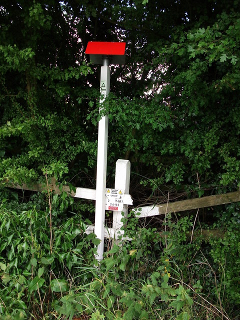
Image: © John Brightley Taken: 17 Jul 2010
The marker reads 'Caution buried pipeline -UKOP- Leg T-M7 -Km 24.95' The United Kingdom Oil Pipeline (UKOP) is an oil products pipeline opened in 1969 and connecting the two (then) Shell refineries of Stanlow (Cheshire) and Shell Haven (Thames Estuary). It is administered and operated by the British Pipeline Agency (BPA) which is jointly owned by Shell and BP. UKOP transports 7.5 million tonnes of mixed products each year distributed to major oil terminals at Buncefield and Kingsbury with spurs to Northampton and Nottingham. UKOP now draws its products from Shell Stanlow in the north and Petroplus Coryton in the south, with smaller volumes from tankage at Shell Haven. UKOP carries two grades of petrol, two grades of kerosene (including Jet A-1) and two grades of gas oil/diesel. (Information from wikipedia, July 2010)
Images are licensed for reuse under creativecommons.org/licenses/by-sa/2.0
Image Location

Latitude
52.378057
Longitude
-1.607581