Houses in Aldrich Road, Oxford
Introduction
The photograph on this page of Houses in Aldrich Road, Oxford by Brian Robert Marshall as part of the Geograph project.
The Geograph project started in 2005 with the aim of publishing, organising and preserving representative images for every square kilometre of Great Britain, Ireland and the Isle of Man.

There are currently over 7.5m images from over 14,400 individuals and you can help contribute to the project by visiting https://www.geograph.org.uk
Houses in Aldrich Road, Oxford
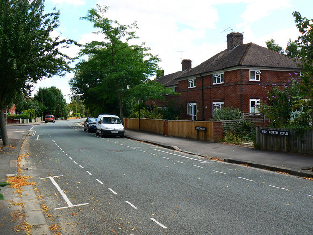
Image: © Brian Robert Marshall Taken: 28 Jul 2010
This is on the face of it an unremarkable view of a typical pre-war municipal housing development; a view that could be replicated just about anywhere in southern England. However, if I had been standing in the same spot at any time between late 1934 and early 1959 my view would have been blocked by a mini version of the Berlin Wall. The reasons for this are all to do the fear of people who are 'not quite our class darling'. Note. This image has a detailed ‘shared description’ which you won’t see by viewing this image on a slideshow. To read it click on the image.
Images are licensed for reuse under creativecommons.org/licenses/by-sa/2.0
Image Location
Latitude
51.785283
Longitude
-1.265103