Road and rail, viewed from Parkland Walk
Introduction
The photograph on this page of Road and rail, viewed from Parkland Walk by Robert Lamb as part of the Geograph project.
The Geograph project started in 2005 with the aim of publishing, organising and preserving representative images for every square kilometre of Great Britain, Ireland and the Isle of Man.

There are currently over 7.5m images from over 14,400 individuals and you can help contribute to the project by visiting https://www.geograph.org.uk
Road and rail, viewed from Parkland Walk
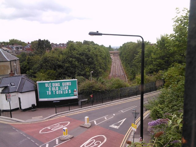
Image: © Robert Lamb Taken: 27 Jul 2010
The road in the bottom left hand corner of the photograph and passing beneath Parkland Walk is Stapleton Hall Road. The road passing over the railway is Lancaster Road, whilst the railway is the London Overground from Barking between Crouch Hill and Harringay Green Lanes stations. Looking north-northeast from the Parkland Walk viaduct.
Images are licensed for reuse under creativecommons.org/licenses/by-sa/2.0
Image Location
Latitude
51.57395
Longitude
-0.111339