West Brook at Hampton
Introduction
The photograph on this page of West Brook at Hampton by Stephen Craven as part of the Geograph project.
The Geograph project started in 2005 with the aim of publishing, organising and preserving representative images for every square kilometre of Great Britain, Ireland and the Isle of Man.

There are currently over 7.5m images from over 14,400 individuals and you can help contribute to the project by visiting https://www.geograph.org.uk
West Brook at Hampton
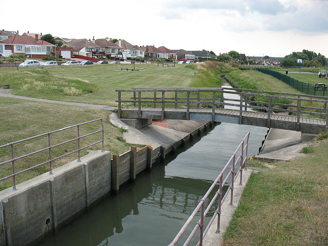
Image: © Stephen Craven Taken: 24 Jul 2010
The brook rises 5km inland in Thornden Wood Image and comes to its outfall here alongside Hampton Pier Avenue (left). Just to the left of the photographer there is a sluice gate, presumably to keep up the water level in this section of the brook but prevent flooding. The bridge is seen from a different anlge in Image
Images are licensed for reuse under creativecommons.org/licenses/by-sa/2.0
Image Location
Latitude
51.369703
Longitude
1.097955