Crown Court
Introduction
The photograph on this page of Crown Court by Ian Taylor as part of the Geograph project.
The Geograph project started in 2005 with the aim of publishing, organising and preserving representative images for every square kilometre of Great Britain, Ireland and the Isle of Man.

There are currently over 7.5m images from over 14,400 individuals and you can help contribute to the project by visiting https://www.geograph.org.uk
Crown Court
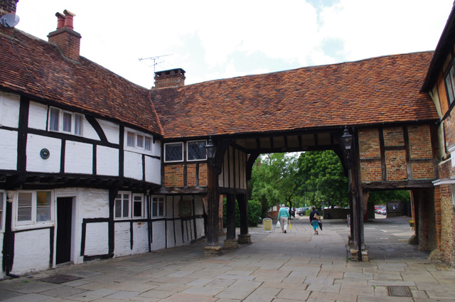
Image: © Ian Taylor Taken: 16 Jul 2010
A medieval weaver's court was partially demolished in 1956, to provide an exit from the new car park into the High Street. This exit only lasted about 20 years due to traffic problems and the building of the town centre relief road (Flambard Way). See Image & http://www.francisfrith.com/godalming/photos/car-park-1956_g23076 .
Images are licensed for reuse under creativecommons.org/licenses/by-sa/2.0
Image Location


Leaflet Map data © OpenStreetMap
Latitude
51.185738
Longitude
-0.61262