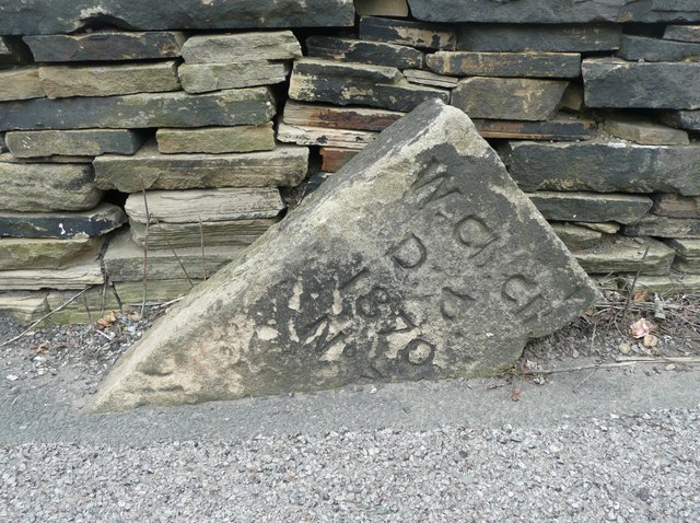
Boundary stone, Windhill Old Road Thackley
Introduction
The photograph on this page of Boundary stone, Windhill Old Road Thackley by Humphrey Bolton as part of the Geograph project.
The Geograph project started in 2005 with the aim of publishing, organising and preserving representative images for every square kilometre of Great Britain, Ireland and the Isle of Man.
There are currently over 7.5m images from over 14,400 individuals and you can help contribute to the project by visiting https://www.geograph.org.uk

Image: © Humphrey Bolton Taken: 24 Jul 2010
To the left of the stone it is Thackley Old Road, Windhill. The inscription is difficult to understand. W. a. a. / D. K. / 1870 / No. 3 (?). Both Thackley and Windhill were in the township and ecclesiastical parish of Idle, but in 1870 Windhill became a separate parish, and also an Urban Sanitary District in 1875. It became part of Shipley Urban District, so that the stone was on a local government boundary until 1974. The date 1870 and the number make it very likely that this was one of a series of stones marking the boundary of the newly created parish.

