Presbytery and Church of Our Lady Help of Christians and St Denis, St Marychurch
Introduction
The photograph on this page of Presbytery and Church of Our Lady Help of Christians and St Denis, St Marychurch by Derek Harper as part of the Geograph project.
The Geograph project started in 2005 with the aim of publishing, organising and preserving representative images for every square kilometre of Great Britain, Ireland and the Isle of Man.

There are currently over 7.5m images from over 14,400 individuals and you can help contribute to the project by visiting https://www.geograph.org.uk
Presbytery and Church of Our Lady Help of Christians and St Denis, St Marychurch
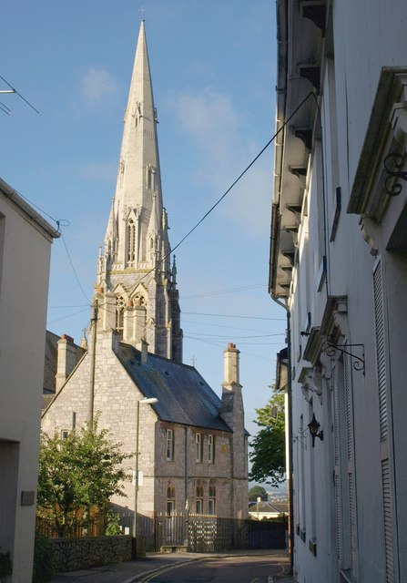
Image: © Derek Harper Taken: 21 Jul 2010
Looking down Priory Road from the junction with Fore Street. The Presbytery http://www.britishlistedbuildings.co.uk/en-390763-presbytery-to-church-of-our-lady-help-of and the church https://historicengland.org.uk/listing/the-list/list-entry/1206830?section=official-listing both date from 1865, and were designed by Joseph Hansom. "A remarkably intact C19 Roman Catholic church".
Images are licensed for reuse under creativecommons.org/licenses/by-sa/2.0
Image Location
Latitude
50.482643
Longitude
-3.525017