The Snipe
Introduction
The photograph on this page of The Snipe by David Dixon as part of the Geograph project.
The Geograph project started in 2005 with the aim of publishing, organising and preserving representative images for every square kilometre of Great Britain, Ireland and the Isle of Man.

There are currently over 7.5m images from over 14,400 individuals and you can help contribute to the project by visiting https://www.geograph.org.uk
The Snipe
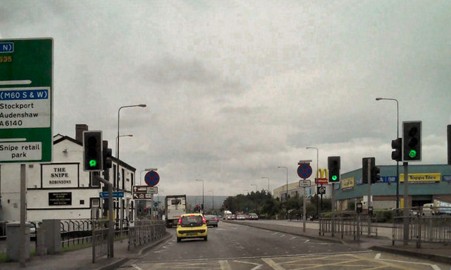
Image: © David Dixon Taken: 20 Jul 2010
The Snipe Inn, on the left hand side of the road, is probably all that remains in this area from the 1960s. To the left, Ashton Moss has been covered with a motorway junction, link roads and industrial units. On the right, Moss Colliery (also known as Snipe Colliery) has been replaced by the Snipe Retail Park.
Images are licensed for reuse under creativecommons.org/licenses/by-sa/2.0
Image Location
Latitude
53.479099
Longitude
-2.125822