Tower 42
Introduction
The photograph on this page of Tower 42 by Claire Ward as part of the Geograph project.
The Geograph project started in 2005 with the aim of publishing, organising and preserving representative images for every square kilometre of Great Britain, Ireland and the Isle of Man.

There are currently over 7.5m images from over 14,400 individuals and you can help contribute to the project by visiting https://www.geograph.org.uk
Tower 42
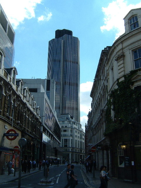
Image: © Claire Ward Taken: 17 Jun 2005
Formerly the Nat West Tower and once bomb damaged, now known as Tower 42. Taken from half way up the left side of the grid square opposite Liverpool St bus station looking almost due south.
Images are licensed for reuse under creativecommons.org/licenses/by-sa/2.0
Image Location
Latitude
51.516773
Longitude
-0.08459