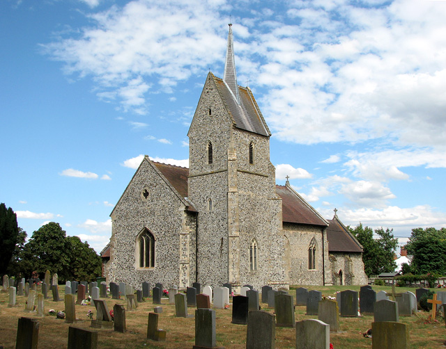
St Leonard's church in Mundford
Introduction
The photograph on this page of St Leonard's church in Mundford by Evelyn Simak as part of the Geograph project.
The Geograph project started in 2005 with the aim of publishing, organising and preserving representative images for every square kilometre of Great Britain, Ireland and the Isle of Man.
There are currently over 7.5m images from over 14,400 individuals and you can help contribute to the project by visiting https://www.geograph.org.uk

Image: © Evelyn Simak Taken: 21 Jul 2010
St Leonard's church > http://www.geograph.org.uk/photo/1974069 dates from the 13th and 14th centuries but has been much altered since. The original west tower collapsed in the 18th century and was replaced by a new one that was placed at the south-west corner of the nave. The church was extensively restored in Victorian times when a new east window, alabaster reredos > http://www.geograph.org.uk/photo/1974080 and rood screen > http://www.geograph.org.uk/photo/1974074 as well as pulpit, lectern, organ case, ceiling > http://www.geograph.org.uk/photo/1974081 and chancel furniture > http://www.geograph.org.uk/photo/1974086 were installed. The architect was Sir Ninian Comper. The rood screen incorporates six original medieval upright posts and a carved crossbeam with carvings > http://www.geograph.org.uk/photo/1974084.

