Flush Bracket, Holywood
Introduction
The photograph on this page of Flush Bracket, Holywood by Rossographer as part of the Geograph project.
The Geograph project started in 2005 with the aim of publishing, organising and preserving representative images for every square kilometre of Great Britain, Ireland and the Isle of Man.

There are currently over 7.5m images from over 14,400 individuals and you can help contribute to the project by visiting https://www.geograph.org.uk
Flush Bracket, Holywood
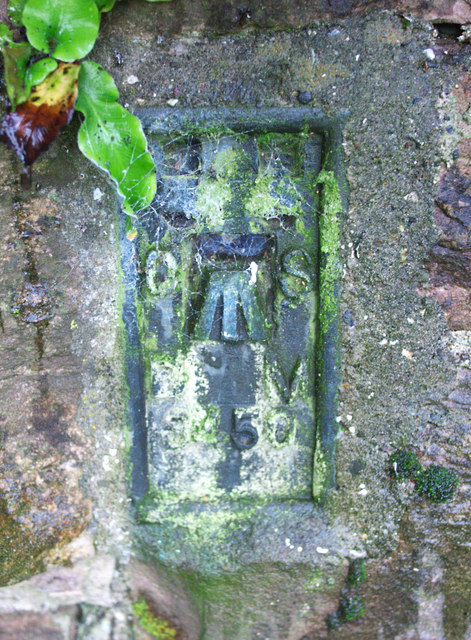
Image: © Rossographer Taken: 21 Jul 2010
Flush bracket located on the railway bridge on Farmhill Road, Holywood Image Somewhat inexplicably, the bracket is on the north-eastern side of the eastern wall of the bridge - i.e. on the far side of the road directly overhanging the railway. To access the bracket it would have been necessary to plant a long ladder on the railway below or precariously hang over the edge - which is what I had to do to get the photograph. The number on the bracket is OSBM 3450. The mark is 30.65 metres above MSL. A flush bracket is a type of bench mark set onto the face of a building. See also http://www.geograph.org.uk/search.php?i=11037856 for many other examples I have found.
Images are licensed for reuse under creativecommons.org/licenses/by-sa/2.0
Image Location
Latitude
54.64721
Longitude
-5.81623