Bridestowe Station
Introduction
The photograph on this page of Bridestowe Station by Ben Brooksbank as part of the Geograph project.
The Geograph project started in 2005 with the aim of publishing, organising and preserving representative images for every square kilometre of Great Britain, Ireland and the Isle of Man.

There are currently over 7.5m images from over 14,400 individuals and you can help contribute to the project by visiting https://www.geograph.org.uk
Bridestowe Station
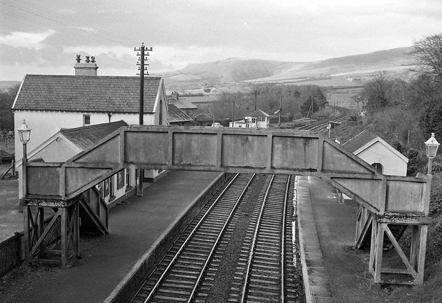
Image: © Ben Brooksbank Taken: 17 Apr 1964
View NE, towards Okehampton and Exeter; ex-London & South Western, Exeter - Okehampton - Plymouth main line. The station was closed completely, along with the line (Okehampton - Bere Alston) on 6/5/68.
Images are licensed for reuse under creativecommons.org/licenses/by-sa/2.0
Image Location
Latitude
50.66585
Longitude
-4.092166