Greenford East Signal Box - the diagram
Introduction
The photograph on this page of Greenford East Signal Box - the diagram by Peter Whatley as part of the Geograph project.
The Geograph project started in 2005 with the aim of publishing, organising and preserving representative images for every square kilometre of Great Britain, Ireland and the Isle of Man.

There are currently over 7.5m images from over 14,400 individuals and you can help contribute to the project by visiting https://www.geograph.org.uk
Greenford East Signal Box - the diagram
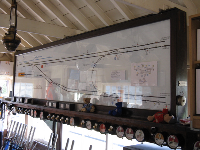
Image: © Peter Whatley Taken: 17 Jul 2010
The signaller's diagram shows the triangular layout controlled by the signalbox. The vast majority of trains handled run between the single platform at Greenford station (orange area bottom left of the diagram) and the lines to Ealing (bottom right).
Images are licensed for reuse under creativecommons.org/licenses/by-sa/2.0
Image Location
Latitude
51.541445
Longitude
-0.340534