Slough New signalbox - overview screen
Introduction
The photograph on this page of Slough New signalbox - overview screen by Peter Whatley as part of the Geograph project.
The Geograph project started in 2005 with the aim of publishing, organising and preserving representative images for every square kilometre of Great Britain, Ireland and the Isle of Man.

There are currently over 7.5m images from over 14,400 individuals and you can help contribute to the project by visiting https://www.geograph.org.uk
Slough New signalbox - overview screen
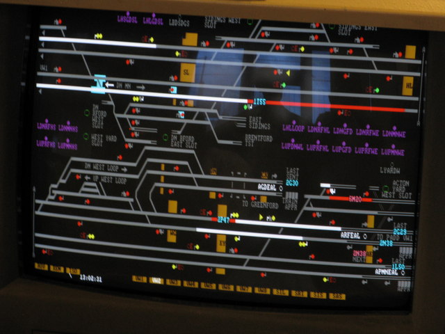
Image: © Peter Whatley Taken: 17 Jul 2010
An example of the computer-based screen and control system in use at Slough New signalbox. In this system, the signaller sees one or more screens providing an overview of his/her control area, on which there is a minimum of information necessary to monitor the progress of trains. Signalling and route-setting for trains is normally fully automatic by computer, based on the timetable for the area. Note that while trains' positions are shown (red lines on the screen) complete with their signalling identity tags (e.g. 1T55), other information is either abbreviated (e.g. SL for Southall which 1T55 is approaching) or absent. There are, for example, no signal, point or track circuit numbers shown. That information can be readily displayed by calling up a more detailed screen from the computer, such as http://www.geograph.org.uk/photo/1967948. Photograph taken under the supervision of Network Rail management.
Images are licensed for reuse under creativecommons.org/licenses/by-sa/2.0
Image Location
Latitude
51.513048
Longitude
-0.596792