Wareham signal box and foot crossing
Introduction
The photograph on this page of Wareham signal box and foot crossing by roger geach as part of the Geograph project.
The Geograph project started in 2005 with the aim of publishing, organising and preserving representative images for every square kilometre of Great Britain, Ireland and the Isle of Man.

There are currently over 7.5m images from over 14,400 individuals and you can help contribute to the project by visiting https://www.geograph.org.uk
Wareham signal box and foot crossing
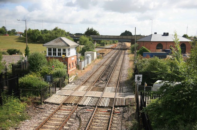
Image: © roger geach Taken: 3 Jul 2010
Looking towards Poole the crossing in front was once the main road until the bridge in the background was built in 1980. Now it is just a foot crossing. The signal box can be seen standing on the left.
Images are licensed for reuse under creativecommons.org/licenses/by-sa/2.0
Image Location


Leaflet Map data © OpenStreetMap
Latitude
50.693303
Longitude
-2.113067