Sourhall Road, Clough Foot, Todmorden
Introduction
The photograph on this page of Sourhall Road, Clough Foot, Todmorden by Humphrey Bolton as part of the Geograph project.
The Geograph project started in 2005 with the aim of publishing, organising and preserving representative images for every square kilometre of Great Britain, Ireland and the Isle of Man.

There are currently over 7.5m images from over 14,400 individuals and you can help contribute to the project by visiting https://www.geograph.org.uk
Sourhall Road, Clough Foot, Todmorden
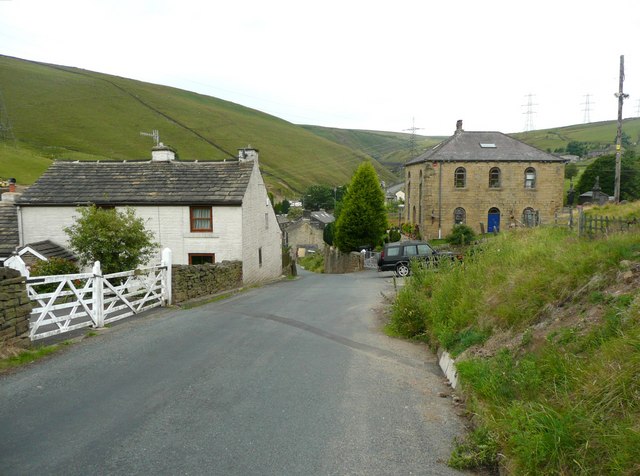
Image: © Humphrey Bolton Taken: 13 Jul 2010
This part of the road is called Back o'th' Edge on the 1848 map. The road name was changed on maps to Sourhall Road between 1894 and 1907. The buildings are at the edge of the hamlet, and the one on the right is a former Independent chapel, and is just in the next square (SD9023).
Images are licensed for reuse under creativecommons.org/licenses/by-sa/2.0
Image Location
Latitude
53.710542
Longitude
-2.13783