Maida Vale Underground Station
Introduction
The photograph on this page of Maida Vale Underground Station by Richard Rogerson as part of the Geograph project.
The Geograph project started in 2005 with the aim of publishing, organising and preserving representative images for every square kilometre of Great Britain, Ireland and the Isle of Man.

There are currently over 7.5m images from over 14,400 individuals and you can help contribute to the project by visiting https://www.geograph.org.uk
Maida Vale Underground Station
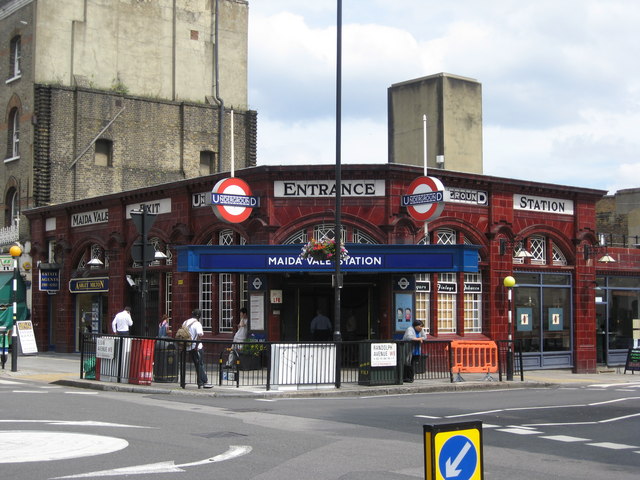
Image: © Richard Rogerson Taken: 8 Jul 2010
Maida Vale takes its name from the Battle of Maida in southern Italy where the British defeated the French in 1806. Shortly afterwards the Hero of Maida Inn was opened in the Edgware Road and the surrounding neighbourhood of Maida Hill and later Maida Vale spread out around it. Maida vale Station was opened in 1915 and is now a Grade II listed building.
Images are licensed for reuse under creativecommons.org/licenses/by-sa/2.0
Image Location
Latitude
51.529888
Longitude
-0.185538