Looking west along the Fairbottom Branch Canal in Daisy Nook Country Park
Introduction
The photograph on this page of Looking west along the Fairbottom Branch Canal in Daisy Nook Country Park by Martin Clark as part of the Geograph project.
The Geograph project started in 2005 with the aim of publishing, organising and preserving representative images for every square kilometre of Great Britain, Ireland and the Isle of Man.

There are currently over 7.5m images from over 14,400 individuals and you can help contribute to the project by visiting https://www.geograph.org.uk
Looking west along the Fairbottom Branch Canal in Daisy Nook Country Park
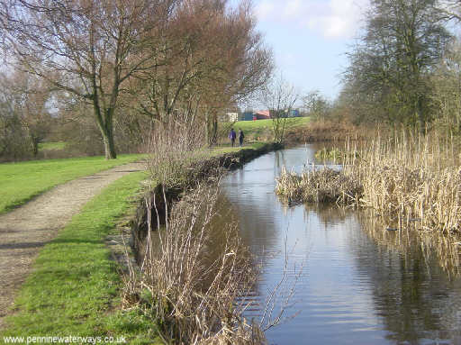
Image: © Martin Clark Taken: Unknown
The Fairbottom Branch Canal ran eastwards from the Hollinwood Branch Canal to Fenny Fields Bridge, where it met a tramway that carried coal from the mines at Fairbottom and Rocher Vale, Park Bridge. More about the canal can be found at www.hollinwoodcanal.co.uk
Images are licensed for reuse under creativecommons.org/licenses/by-sa/2.0
Image Location


Leaflet Map data © OpenStreetMap
Latitude
53.510129
Longitude
-2.11456