Parkin Lane, Todmorden
Introduction
The photograph on this page of Parkin Lane, Todmorden by Humphrey Bolton as part of the Geograph project.
The Geograph project started in 2005 with the aim of publishing, organising and preserving representative images for every square kilometre of Great Britain, Ireland and the Isle of Man.

There are currently over 7.5m images from over 14,400 individuals and you can help contribute to the project by visiting https://www.geograph.org.uk
Parkin Lane, Todmorden
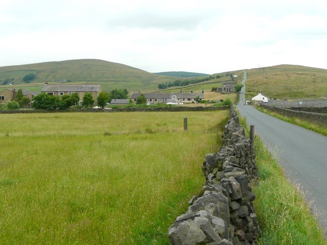
Image: © Humphrey Bolton Taken: 13 Jul 2010
The hamlet could be named Sourhall as the terrace houses in the centre of the view are Sourhall Cottages on Sourhall Road. These were originally Peel Mill, and became an Isolation Hospital in 1874 which lasted until 1949 (see http://www.todmordenandwalsden.co.uk/ ). The white public house building was Sour Hall on the 1848 six-inch map and has been called 'The Sourhall', the Olde Dog and Partridge and currently the Country Friends. There do not seem to have been enough friends, however, as the pub looks very neglected and probably closed. Tower Causeway continues straight forward, unfenced over Lower Moor.
Images are licensed for reuse under creativecommons.org/licenses/by-sa/2.0
Image Location
Latitude
53.717745
Longitude
-2.127247