Ordnance Survey bench mark, St. Andrew's Church
Introduction
The photograph on this page of Ordnance Survey bench mark, St. Andrew's Church by Rose and Trev Clough as part of the Geograph project.
The Geograph project started in 2005 with the aim of publishing, organising and preserving representative images for every square kilometre of Great Britain, Ireland and the Isle of Man.

There are currently over 7.5m images from over 14,400 individuals and you can help contribute to the project by visiting https://www.geograph.org.uk
Ordnance Survey bench mark, St. Andrew's Church
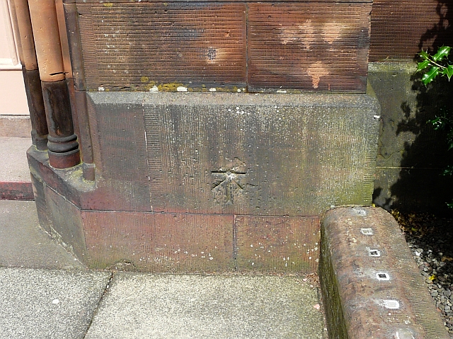
Image: © Rose and Trev Clough Taken: 3 Jul 2010
Located just to the right of the front door, seen here Image . For information and a searchable bench marks locator, see the Ordnance Survey website http://benchmarks.ordnancesurvey.co.uk/pls/htmldb/f?p=111:3:6255072357299077241::NO:3:: . This cut mark with metal bolt is now redundant, due to improved surveying technology. The level was last checked in 1974 - 16.602m above Mean Sea Level (OD Newlyn).
Images are licensed for reuse under creativecommons.org/licenses/by-sa/2.0
Image Location
Latitude
54.986357
Longitude
-3.261878