Standing stone, Li
Introduction
The photograph on this page of Standing stone, Li by Nic Bullivant as part of the Geograph project.
The Geograph project started in 2005 with the aim of publishing, organising and preserving representative images for every square kilometre of Great Britain, Ireland and the Isle of Man.

There are currently over 7.5m images from over 14,400 individuals and you can help contribute to the project by visiting https://www.geograph.org.uk
Standing stone, Li
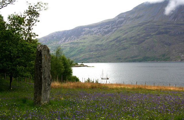
Image: © Nic Bullivant Taken: 6 Jun 2010
This field of bluebells runs down to the shore of Loch Hourn with a view of Beinn Sgritheall and Arnisdale, and passing boats. Someone has decided to put up a large stone slab as a standing stone. It is not listed in the database of the Royal Commission on Ancient and Historic Monuments for Scotland, so it can be safely assumed to be recent.
Images are licensed for reuse under creativecommons.org/licenses/by-sa/2.0
Image Location


Leaflet Map data © OpenStreetMap
Latitude
57.108347
Longitude
-5.579098