No. 6, Grape Lane
Introduction
The photograph on this page of No. 6, Grape Lane by Mike Kirby as part of the Geograph project.
The Geograph project started in 2005 with the aim of publishing, organising and preserving representative images for every square kilometre of Great Britain, Ireland and the Isle of Man.

There are currently over 7.5m images from over 14,400 individuals and you can help contribute to the project by visiting https://www.geograph.org.uk
No. 6, Grape Lane
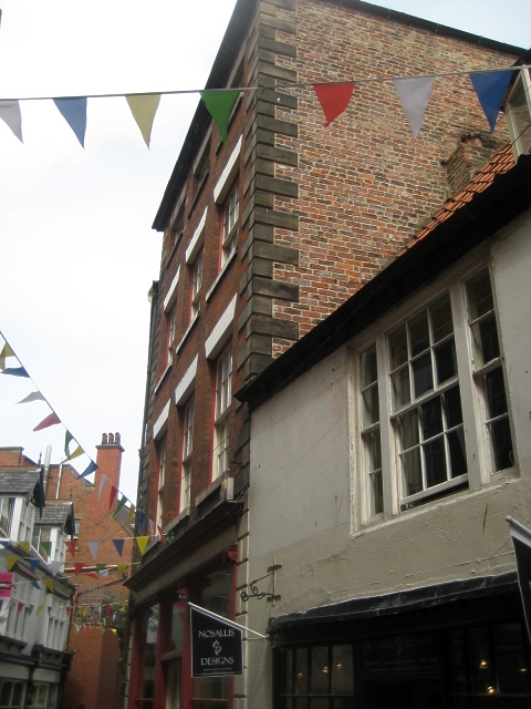
Image: © Mike Kirby Taken: 4 Jul 2010
A grade II listed building from the early C19. Comprising 4 storeys in brick with rusticated stone quoins. Stone cornice and blocking course. Modern ground floor shop front. LBS Number: 326794
Images are licensed for reuse under creativecommons.org/licenses/by-sa/2.0
Image Location


Leaflet Map data © OpenStreetMap
Latitude
54.486942
Longitude
-0.611959