Bynea Station
Introduction
The photograph on this page of Bynea Station by Ben Brooksbank as part of the Geograph project.
The Geograph project started in 2005 with the aim of publishing, organising and preserving representative images for every square kilometre of Great Britain, Ireland and the Isle of Man.

There are currently over 7.5m images from over 14,400 individuals and you can help contribute to the project by visiting https://www.geograph.org.uk
Bynea Station
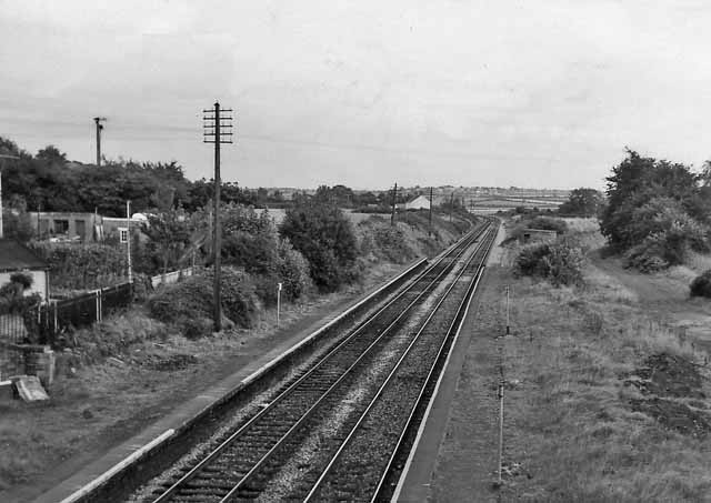
Image: © Ben Brooksbank Taken: 28 Sep 1973
View eastward, towards Pontarddulais; ex-Great Western (Llanelly Railway) (Pantyffynnon-) - Pontarddulais - Llanelli line, now the southern end of the Heart of Wales Line, (Shrewsbury -) Craven Arms - Llandovery - Swansea, which was closed Ponatrddulais - Swansea (Victoria) on 15/6/64 (Goods 4/10/65).
Images are licensed for reuse under creativecommons.org/licenses/by-sa/2.0
Image Location


Leaflet Map data © OpenStreetMap
Latitude
51.672262
Longitude
-4.098458