Site of Butler's Hill Station
Introduction
The photograph on this page of Site of Butler's Hill Station by Ben Brooksbank as part of the Geograph project.
The Geograph project started in 2005 with the aim of publishing, organising and preserving representative images for every square kilometre of Great Britain, Ireland and the Isle of Man.

There are currently over 7.5m images from over 14,400 individuals and you can help contribute to the project by visiting https://www.geograph.org.uk
Site of Butler's Hill Station
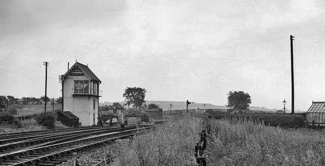
Image: © Ben Brooksbank Taken: 12 Jul 1963
View southward, towards Nottingham (Victoria) and Colwick Yard etc.; ex-Great Northern Leen Valley line, Nottingham and Netherfield & Colwick - Shirebrook. The station closed to passengers when the service was withdrawn on 14/9/31, but coal traffic still ran over this stretch until 1968. There is now a 'Butler's Hill' tram-stop near here on the Nottingham Express Transit system.
Images are licensed for reuse under creativecommons.org/licenses/by-sa/2.0
Image Location
Latitude
53.030399
Longitude
-1.19059