East Dereham Windmill
Introduction
The photograph on this page of East Dereham Windmill by Ashley Dace as part of the Geograph project.
The Geograph project started in 2005 with the aim of publishing, organising and preserving representative images for every square kilometre of Great Britain, Ireland and the Isle of Man.

There are currently over 7.5m images from over 14,400 individuals and you can help contribute to the project by visiting https://www.geograph.org.uk
East Dereham Windmill
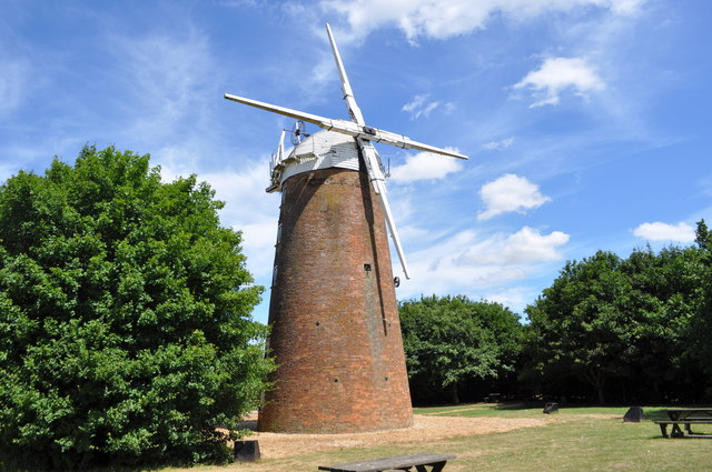
Image: © Ashley Dace Taken: 10 Jul 2010
See http://www.norfolkmills.co.uk/Windmills/east-dereham-towermill.html This link has more information about the mill. Now set in a picnic ground at East Dereham. Sadly the future now uncertain, the mill has been boarded up and weatherproofed. A housing estate has sprug up since my last visit in the 1990s.
Images are licensed for reuse under creativecommons.org/licenses/by-sa/2.0
Image Location
Latitude
52.678191
Longitude
0.961923