Clare Common
Introduction
The photograph on this page of Clare Common by Bob Jones as part of the Geograph project.
The Geograph project started in 2005 with the aim of publishing, organising and preserving representative images for every square kilometre of Great Britain, Ireland and the Isle of Man.

There are currently over 7.5m images from over 14,400 individuals and you can help contribute to the project by visiting https://www.geograph.org.uk
Clare Common
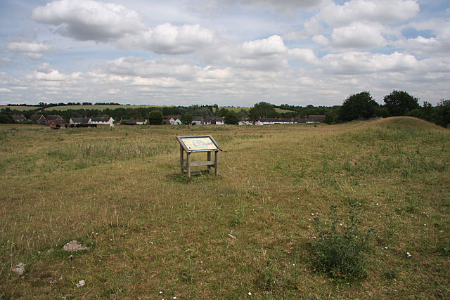
Image: © Bob Jones Taken: 8 Jul 2010
Clare Common is an important archaeological site; the large ditches and banks are probably the defences of an Iron Age site known as Clare Camp, built more than 2,000 years ago. Much of the D-shaped earthwork is still clearly visible, although erosion and later alterations have reduced the size of the banks. About 700 years ago, the medieval manor of Erbury (taking its name from this 'earth-burh' or earth fort) stood within this site. Some outlines on the ground suggest the sites of at least two large buildings, with courtyards. Medieval documents suggest that there were barns, a dovehouse, a granary and servants' quarters. In the early 1500s, Katherine of Aragon gave this land to be a common pasture for the poor to graze their cattle on. The Lower Common has been grazed ever since.
Images are licensed for reuse under creativecommons.org/licenses/by-sa/2.0
Image Location
Latitude
52.082496
Longitude
0.578976