Industrial Buildings, Foundry Street, Todmorden
Introduction
The photograph on this page of Industrial Buildings, Foundry Street, Todmorden by Humphrey Bolton as part of the Geograph project.
The Geograph project started in 2005 with the aim of publishing, organising and preserving representative images for every square kilometre of Great Britain, Ireland and the Isle of Man.

There are currently over 7.5m images from over 14,400 individuals and you can help contribute to the project by visiting https://www.geograph.org.uk
Industrial Buildings, Foundry Street, Todmorden
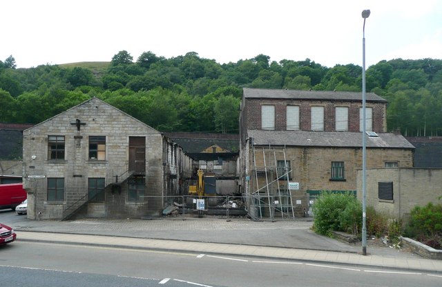
Image: © Humphrey Bolton Taken: 26 Jun 2010
Was the foundry on this site? The large-scale OS map captions the building on the left as 'Works' and the one on the right, including the burnt-out part where the excavator is, and 'Warehouse'. It seems that the gap between two separate buildings had been filled by constructing a roof over it, but that roof has been destroyed by fire. The building to the right of the lamp-post is captioned "El Sub Sta" (Electricity sub-station).
Images are licensed for reuse under creativecommons.org/licenses/by-sa/2.0
Image Location
Latitude
53.711478
Longitude
-2.101472