The Implement Gate, Marsworth
Introduction
The photograph on this page of The Implement Gate, Marsworth by David Hillas as part of the Geograph project.
The Geograph project started in 2005 with the aim of publishing, organising and preserving representative images for every square kilometre of Great Britain, Ireland and the Isle of Man.

There are currently over 7.5m images from over 14,400 individuals and you can help contribute to the project by visiting https://www.geograph.org.uk
The Implement Gate, Marsworth
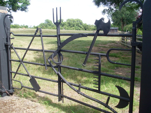
Image: © David Hillas Taken: 3 Jul 2010
Situated in Church Farm Lane, this gate dates from about 1955 and has been created from redundant tools and implements from nearby farms. The postcode of this lane is HP23 4ND.
Images are licensed for reuse under creativecommons.org/licenses/by-sa/2.0
Image Location
Latitude
51.826913
Longitude
-0.67079