ROF 53 memorial tablet - Bridgend
Introduction
The photograph on this page of ROF 53 memorial tablet - Bridgend by Mick Lobb as part of the Geograph project.
The Geograph project started in 2005 with the aim of publishing, organising and preserving representative images for every square kilometre of Great Britain, Ireland and the Isle of Man.

There are currently over 7.5m images from over 14,400 individuals and you can help contribute to the project by visiting https://www.geograph.org.uk
ROF 53 memorial tablet - Bridgend
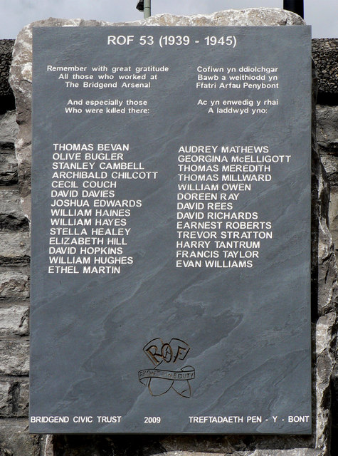
Image: © Mick Lobb Taken: 8 Jul 2010
To the west of Bridgend are the suburbs of Brackla, Coity and Waterton. Now covered in modern housing and industrial estates. In the period 1937 to 1946 they were the location of Royal Ordnance Factories 11,41 and 53. Although only referring to ROF 53 it is otherwise suggested that the memorial is dedicated to all who served in 'The Bridgend Arsenal'. The stone commemorates those whose lives were accidentally taken in this dangerous work in support of British Forces and the war effort. For a comprehensive history of this time and place, not known of by many now living in the area, see: http://www.bridgend.gov.uk/english/library/online_texts/The%20ROF%20Book%20Edition%201.8G.pdf
Images are licensed for reuse under creativecommons.org/licenses/by-sa/2.0
Image Location
Latitude
51.507282
Longitude
-3.580315