Tablet commemorating Bridgend bridges
Introduction
The photograph on this page of Tablet commemorating Bridgend bridges by Mick Lobb as part of the Geograph project.
The Geograph project started in 2005 with the aim of publishing, organising and preserving representative images for every square kilometre of Great Britain, Ireland and the Isle of Man.

There are currently over 7.5m images from over 14,400 individuals and you can help contribute to the project by visiting https://www.geograph.org.uk
Tablet commemorating Bridgend bridges
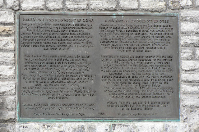
Image: © Mick Lobb Taken: 8 Jul 2010
The tablet describes the history of the bridges over the River Ogmore from 1425 and indicates the effect that expansion of towns has on their infrastructure.
Images are licensed for reuse under creativecommons.org/licenses/by-sa/2.0
Image Location
Latitude
51.507282
Longitude
-3.580315