The Graving Dock from DLR Pontoon Dock Station
Introduction
The photograph on this page of The Graving Dock from DLR Pontoon Dock Station by Kathy Taylor as part of the Geograph project.
The Geograph project started in 2005 with the aim of publishing, organising and preserving representative images for every square kilometre of Great Britain, Ireland and the Isle of Man.

There are currently over 7.5m images from over 14,400 individuals and you can help contribute to the project by visiting https://www.geograph.org.uk
The Graving Dock from DLR Pontoon Dock Station
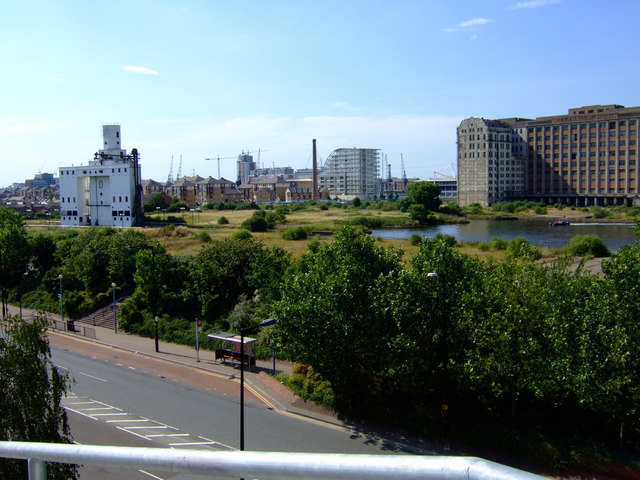
Image: © Kathy Taylor Taken: 3 Jul 2006
Looking across North Woolwich Road to the Graving Dock, which lies on the south side of the Royal Victoria Dock. The white building to the left of the picture is D Silo where grain was unloaded from barges and then milled in Millenniumn Mills, the large building on the right of the shot. In the distance is Britannia Village, which was built about 10 years ago. If you look carefully you can just see the ExCel exhibition centre on the skyline, to left of Millenniumn Mills.
Images are licensed for reuse under creativecommons.org/licenses/by-sa/2.0
Image Location


Leaflet Map data © OpenStreetMap
Latitude
51.502255
Longitude
0.030071