Mausoleum, Hannahstown
Introduction
The photograph on this page of Mausoleum, Hannahstown by Rossographer as part of the Geograph project.
The Geograph project started in 2005 with the aim of publishing, organising and preserving representative images for every square kilometre of Great Britain, Ireland and the Isle of Man.

There are currently over 7.5m images from over 14,400 individuals and you can help contribute to the project by visiting https://www.geograph.org.uk
Mausoleum, Hannahstown
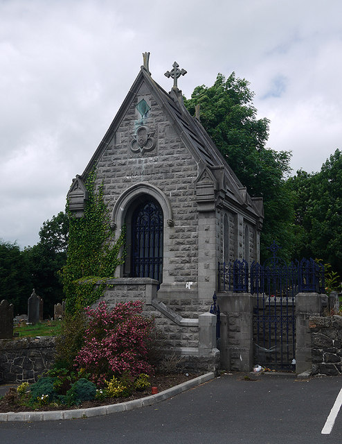
Image: © Rossographer Taken: 7 Jul 2010
The Hamill mausoleum at St Joseph's RC church, Hannahstown Image Worship began in this area around land consecrated by a Fr Hugh O’Donnell in 1797. Land here was donated by a wealthy Catholic landowner called John Hamill - he originally donated one acre of land to be used as a cemetery; his wife Hannah later donated money for a small schoolhouse which was also used as the church (it is likely that the area became known as "Hannah's Town" as a result of this).
Images are licensed for reuse under creativecommons.org/licenses/by-sa/2.0
Image Location
Latitude
54.582078
Longitude
-6.028763