Telegraph Tower
Introduction
The photograph on this page of Telegraph Tower by Richard Croft as part of the Geograph project.
The Geograph project started in 2005 with the aim of publishing, organising and preserving representative images for every square kilometre of Great Britain, Ireland and the Isle of Man.

There are currently over 7.5m images from over 14,400 individuals and you can help contribute to the project by visiting https://www.geograph.org.uk
Telegraph Tower
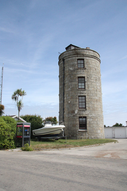
Image: © Richard Croft Taken: 30 Jun 2010
One of three gun towers proposed and built on St.Mary's by Major Daniel Lyman in 1803. It stands at the highest point in the Isles of Scilly, 165 feet above sea level and is now used as a coastguard lookout tower. It reputedly got its name after 1898 when Marconi successfully received wireless signals here from Porthcumo in Cornwall, 30 miles away
Images are licensed for reuse under creativecommons.org/licenses/by-sa/2.0
Image Location
Latitude
49.928977
Longitude
-6.303546