Boardwalk in the mud
Introduction
The photograph on this page of Boardwalk in the mud by David Anstiss as part of the Geograph project.
The Geograph project started in 2005 with the aim of publishing, organising and preserving representative images for every square kilometre of Great Britain, Ireland and the Isle of Man.

There are currently over 7.5m images from over 14,400 individuals and you can help contribute to the project by visiting https://www.geograph.org.uk
Boardwalk in the mud
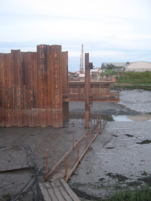
Image: © David Anstiss Taken: 30 Jun 2010
The Sittingbourne Northern Relief Road, runs from Kemsley, then over the creek towards the Eurolink Industrial Estate (in the background, with the yellow crane). The sheet piles are drivn into the ground to make a dry and secure base for part of the creek bridge works. The walk is for workers to access the platform in the creek. The creek is at low tide. See Image for a wider shot.
Images are licensed for reuse under creativecommons.org/licenses/by-sa/2.0
Image Location
Latitude
51.353611
Longitude
0.75586